Off the Grid, On the Page: The Hand-Drawn Map Makers Taking Back the Territory
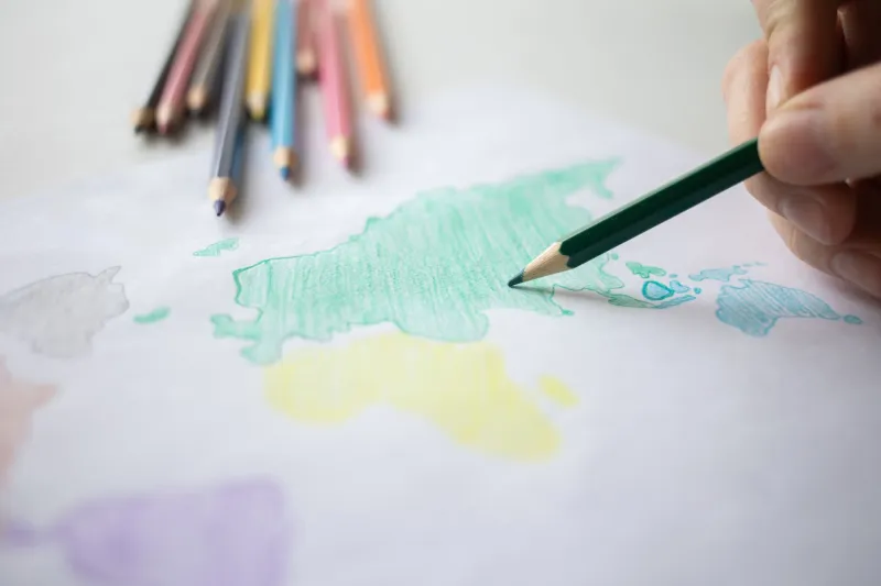
Somewhere in a church basement in East Oakland, a group of about fifteen people are hunched over a long folding table covered in butcher paper. There are colored pencils, india ink, rulers, and a whole lot of strong coffee. Nobody is looking at their phone. They're drawing a map — of their own neighborhood — from memory, from conversation, from the collective knowledge of people who have actually lived there for decades.
This isn't a school project. It's not a quirky art installation. It's resistance.
The Map Is Never Neutral
Here's something cartography professors have known forever but the rest of us are only starting to catch up to: every map is an argument. Every map makes choices about what gets included, what gets erased, and whose reality gets treated as the default. When Google Maps decided which streets to name and which neighborhoods to label, when it drew the boundaries of "good" areas versus "sketchy" ones through star ratings and review aggregates, it was making political decisions dressed up as neutral data.
The underground mapmakers — and yeah, that's actually what some of them call themselves — are done pretending otherwise.
"GPS gives you a coordinate," says Tomás, a community organizer and self-taught cartographer based in Albuquerque whose hand-drawn maps of his South Valley neighborhood have been reproduced and distributed through local mutual aid networks. "It doesn't give you a story. It doesn't tell you that this corner used to have a community garden before the city paved it over, or that this alley is where the elders used to gather on summer nights. That knowledge lives in people. My job is to get it onto paper before it disappears."
Tomás isn't alone. Across the country — from rural Appalachia to the South Side of Chicago to Indigenous communities in the Southwest — people are picking up pens and pencils and drawing the world as they actually experience it. The movement doesn't have a single name or a centralized organization. It's more like a loose, overlapping web of practices that share a common instinct: that the map you're handed is not the map you need.
What Gets Left Off the Corporate Map
Spend five minutes talking to anyone in this world and you'll start noticing the gaps. Google Maps, for all its satellite precision, is shockingly bad at capturing the texture of place. It'll route you around a neighborhood without showing you the murals on the buildings. It'll mark a lot as "vacant" when the community has been using it as an informal park for twenty years. It'll show a business that closed in 2019 and miss the pop-up market that's been operating out of that same space every Saturday since.
Then there are the places that get deliberately obscured — or simply never mapped at all. Tribal lands. Informal settlements. Communities that exist in the gaps of official infrastructure. In some cases, poor and predominantly Black and Brown neighborhoods have been systematically under-resourced in mapping databases, a digital echo of the redlining that shaped American cities in the 20th century.
Hand-drawn maps can document all of this. They can mark the house where the neighborhood elder lives who knows everyone's name. They can trace the informal paths people actually walk instead of the sidewalks that technically exist on paper. They can honor the names communities use for their own streets rather than the names the city assigned.
"We call it counter-cartography," explains Deja, a visual artist and activist in Detroit who runs workshops teaching residents to map their own blocks. "You're not just making a map. You're making a claim. You're saying: this place is real, it has a history, and we are the ones who get to describe it."
The Surveillance Problem Nobody's Talking About
There's another dimension to all of this that doesn't come up as often but probably should: location tracking is one of the most pervasive and least-discussed forms of corporate surveillance in American life. Every time you open a maps app, you're feeding data to a company that sells that data, uses it to shape advertising, and in some cases hands it over to law enforcement.
For communities already living under heavy policing and government scrutiny — undocumented immigrants, activists, people in over-policed neighborhoods — that's not a hypothetical risk. It's a daily calculation.
Analog maps don't ping servers. They don't log your location. They don't update in real time and report back to anyone. A hand-drawn map of a community's resources, safe houses, or mutual aid network exists entirely outside the surveillance infrastructure. That's not a bug. That's the whole point.
"When we distribute paper maps at community events, people respond to it differently than they do to a QR code," says Mira, who organizes with an immigrant rights group in Los Angeles and has helped produce hand-drawn resource guides for newly arrived families. "There's a trust in it. It came from someone who knows this place. It doesn't require you to give anything up to use it."
The Spiritual Geography of Knowing Where You Are
Beyond the political and practical dimensions, a lot of the people doing this work describe it in terms that feel almost devotional. There's something that happens when you sit down and try to draw the place you live from memory — something that forces a kind of attention most of us have outsourced to our devices.
You have to actually know where the sun rises over your street. You have to remember the distance between the corner store and the park. You have to think about which routes feel safe and which feel exposed, and why. Drawing a map is an act of radical presence in a culture that has made presence optional.
"I started doing this because I was angry about surveillance," admits Tomás. "But somewhere along the way it became something else. It became about loving where I live enough to actually see it."
That combination — fury and tenderness, politics and beauty — is what makes this movement feel genuinely alive. It's not nostalgic. Nobody's pretending paper maps are more accurate than satellite imagery. They're making a different argument: that accuracy isn't the only thing that matters. That the knowledge a community carries about itself is worth preserving, worth fighting for, and worth drawing.
Pick Up a Pen
If you want to find these communities, you mostly have to look offline — which is, in its own way, a kind of test. Zines at independent bookstores. Workshops at community centers and libraries. Social media accounts that post sporadically and don't try to go viral. The Oakland group has been meeting in that church basement for three years and has never once issued a press release.
But if you do find them, bring your own colored pencils. And leave your phone in your bag — or at least turn off location services. The map you're about to make doesn't need to know where you are. That's the whole point.